Birding In The Areas From Mareeba To Mt Carbine and around Kingfisher Park Birdwatchers Lodge
Distances are from Kingfisher Park Birdwatchers Lodge
The descriptions will give you an idea of what type of species you might expect to see at the locations and any special requirement to visit. More information will be available upon your arrival.
Mt. Lewis – 12.5 km
The Bushy Creek bridge, at the bottom of Mt Lewis Road was washed away during the December 2023 floods that were caused by Cyclone Jasper. The bridge was rebuilt and reopened one year later. Currently, the National Park Service is clearing the many land-slides that occured due to the 2m of rain that fell over 5 days. The road is still closed as they try to make a navigable route. It is likely that the road will be 4DW only until more money becomes available.
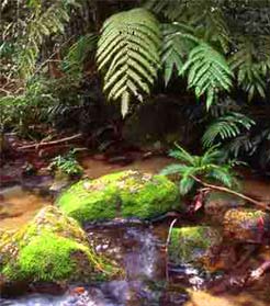
The Mt. Lewis Road is 1.5km from the Lodge and winds its way up to 950m where the best birding location is on the mountain. The road is only sealed for 1 km before changing to gravel for the remaining 10 km, this section can become impassable after heavy rain, especially due to fallen trees, so you need to check the road conditions before you attempt to traverse it. The road has been well graded over the last few years so a 2WD vehicle will generally be fine to take up the mountain. This is the place to look for the Blue-faced Parrot-Finch between November and April, also other upland rainforest species such as Chowchilla. Golden and Tooth-billed Bowerbird, Atherton Scrubwren and Mountain Thornbill. The main birdwatching area of Mt. Lewis forms part of the Australian Wildlife Conservancy's property Brooklyn Wildlife Sanctuary.
Abattoir Swamp – 6.1 km
Here a bird hide is accessed by a newly refurbished boardwalk, but unfortunately the open water has been overrun by Olive Hymenachne grass. However the woodland area around the car park is often productive (look for Northern Fantail here) and when the paperbark trees are flowering large numbers of lorikeets and honeyeaters are attracted to the area. Can be good for Spotless and White-browed Crake.
Maryfarms – 30.4 km
This is a reliable site for Australian Bustard viewed from the East or West Mary Roads. Use your car as a hide for best viewing but pull off safely on grass verge.
Mt.Carbine – 38.9 km
The Mt. Carbine dam is closed due to mining activity in the area and no longer has access. Birding in the area can be done in the surrounding woodland, especially along the road to the cemetery, which is on the left north of the township. It is signposted.
Luster & Station Creeks – 21.4 km & 25.3 km
Both these creeks are on the Australian Wildlife Conservancy's property Brooklyn Wildlife Sanctuary. Good woodland habitat.
Mount Molloy – 11.3 km
Famous for its number of Great Bowerbirds and bowers also Red-winged Parrot, Pale-headed Rosella and Squatter Pigeon.
Lake Mitchell – 25.2 km
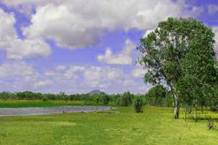
The lake can be viewed from 2 roadside lay-bys. Waterbirds can be in good numbers but are subject to varying conditions around Queensland.
Big Mitchell Creek - 27.9 km
White-browed Robin can be looked for here as well as other dry country species. Due to over burning the area is not what it once was.
Mareeba Wetlands – 49.9 km
Extensive wetland and woodland habitat. Not open to the public anymore but the road to the wetlands gate can be worth birding.
Mowbray National Park
Small walking track through rainforest, which can turn up some of the more difficult rainforest species, including fruit-doves and the occasional Southern Cassowary.
Wetherby Road
An alternative road from Julatten to Mount Molloy passes through Wetherby Station which is open woodland cattle country with a good variety of bushbirds. The road passes a small wetland near the homestead which can be good for waterbirds. This road can be impassable after rains.
Approximate Driving Times to Mossman Gorge, Daintree Village, Cape Tribulation, Port Douglas, Atherton and Cairns.
Mossman Gorge is about 35 mins
Can get crowded. There is a shuttle bus (charge applies) to the start of the walk through the rainforest along the river. Best early morning or late afternoon for rainforest birds.
Daintree Village is 55 mins
The specialised birding Daintree River cruise boats start here.
Cape Tribulation - 1hr 50 mins
Take the ferry across the Daintrree River into an interesting lowland rainforest area. There are several walks through the rainforest and mangroves with a possibility of Southern Cassowary.
Port Douglas - 35 mins
Reef trips depart from here.
Atherton - 1 hour
Central to the many different habitats on the Atherton Tableland.
Cairns 1hr 30 mins
The time is about the same whether you go via Mareeba on the inland route or along the coast.
For more information on birdwatching sites Lloyd Nielsen's "Birding Australia" book covers Australia, including North-east Queensland and is a complete directory of Australian birding that is constantly updated. The book is available direct from Lloyd at Birding Australia.
Information brochures to local birding sites are available for download at the BirdLife Northern Queensland web site. Follow the link and click on Birding in the top navigation bar.


